Paekakariki.nz proudly presents the second in its commissioned series of creative writing to go with our walks. In an epic poem, itself like a track, Michael O’Leary writes historically and contemporaneously about the rail, road and path between Paekākāriki and Pukerua Bay. This series sees our writers paid through funding provided by the Kāpiti Coast District Council Creative Communities scheme. The first story ‘Tūrangawaewae’ by Dani Deluka is here.
Te-Ana-o-Hau
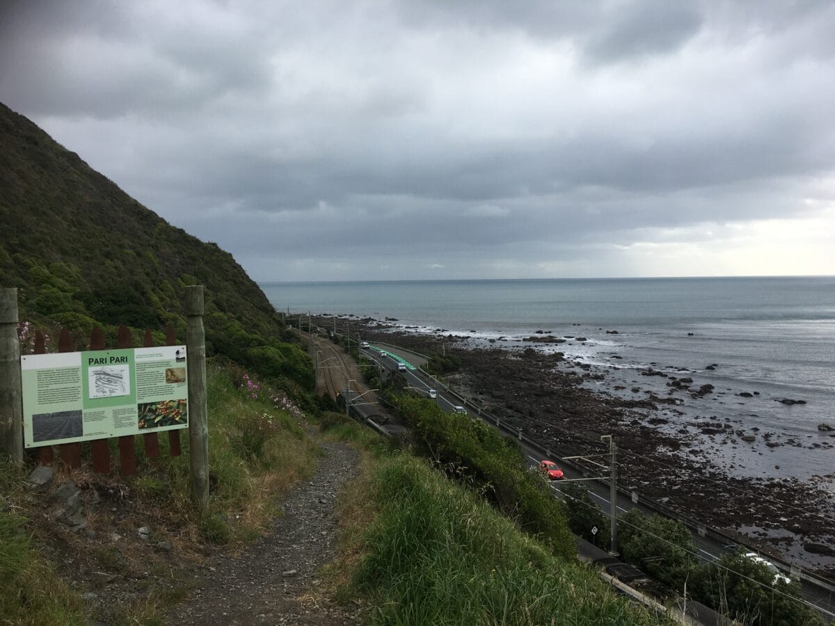
Te Paripari was the name of the great hillside
South of Paekākāriki, which is where the Tararua
Mountain range begins. Māori recognized this and
Named the slopes here paripari, the precipice.
This location is steeped in history, identified
Still today. The area where the cave lies
Is still very important to Māori. It was known as
Te-Ana-o-Hau. The cave is a naturally formed
Sea arch in a greywacke outcrop extending out
To the sea. It was named after a Tupuna or
Ancestor called Hau, who travelled along the
Coast from Taranaki to Paekākāriki, in search
Of his wife, who had left him. Hau
Travelled along the coast, naming every river
And point he came across, until arriving at the
Great rock at the base of Te Paripari. The rock
Then was solid and Hau could hear his wife
Speaking on the other side of it, so he uttered
A powerful karakia and, using his supernatural
Powers, blasted a hole through the rock. After
Retrieving his wife, Hau sent her out to sea to
Gather shellfish and cast a mākutu over her
And she was turned into a rock. That rock is
Wairaka, and the pierced rock remained as a
Token of the power of Hau. Pākehā thought
The rock cave to be the work of nature, but
Māori knew better and called it Te Ana o Hau
‘The Cave of Hau’. Later, when Ngāti Toa Iwi
Travelled along the coast, they would break
Their journey and camp at the sacred rock
For the night, proceeding onward the next day
To Porirua, Takapu and Te Whānganui-aTara
There was a small Māori kāinga near the cliffs
It was known to early settlers and whalers as
‘The Rocky Settlement’. Wakefield described
The location in 1840. “The village was situated
On a terrace on the hill about fifty feet above the
Beach and very neatly built. Below two or three
Canoes were hauled up under some karaka trees
Which formed a pleasant grove in a sort of recess
From the beach. About half a mile north of Paripari
The hills recede from the coast and the rocky slope
Is replaced by a shoal sandy beach backed by
Sand hummocks.” Ten years later, when visited
By Kemp, the kāinga was found to be nestled amongst
Heavy bush, with a population of twenty-two people
Residing there. It had twelve huts, and one church
Or chapel, six horses and two head of cattle. The
Settlement had two waka taua with cultivations of
Both kumara and potato, as well as other produce.
Above where the proposed railway line would be
The site of Paripari could be located as a series of
Small terraces, a short distance up the rocky slopes
From the future line. Signs of occupation included
Shell refuse (mainly pāua), with some fish and dog
Bone and other unidentified bones. Two human
Teeth were found close to each other near some
Midden refuse. By the 1940’s, it was reported that
The downward movement of loose scree material
Had probably caused some of the original occupation
Levels to be covered in places. A small part of the kāinga
Nearest the sea was sliced off to make way for Centennial
Highway and earlier on, the railway line. Behind the kāinga,
A little further up the slope was a karaka grove of sites
Of historic and archaeological significance
Between Paekākāriki and Muri. Although the
Location was severely desecrated during the
Construction of Centennial Highway in the 1930s
And 1940s, today Te-Ana-o-Hau Is still sacred and
Precious to Māori. In more recent times, during |
Remedial work on the highway, Transit NZ hoped
To demolish what was left of the outcrop, but local
Māori would not allow them to do this. Transit argued
That the rock would be weakened during the mahi,
Hence wanting to remove it, but a compromise was
Reached through rock-bolting the outcrop to strengthen
It. It can still be seen on the seaward side. While not
Between North and South Junction, another location
Which directly affects the railway line, is Paripari.
This is the site of another old kāinga, directly above
Railway Track
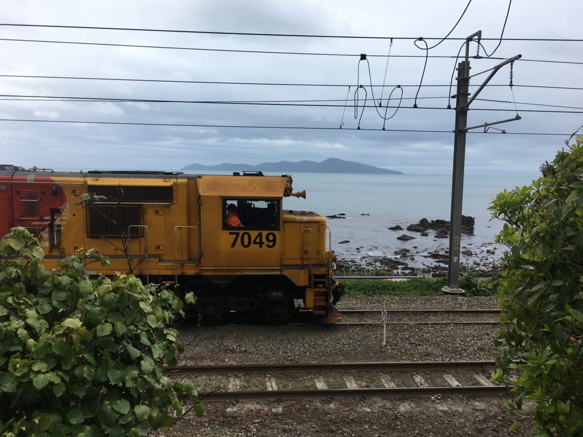
The North-South Junction is the single tracked
Section of line south of Paekākāriki to Muri.
It runs along the steep Paekākāriki coastal
Escarpment and includes a series of tunnels
The railway line, between North and South Junction
Lies about a mile south of the railway quarry. This
Also includes historic kumara pits on the Te Paripari
Escarpment, between North and South Junction.
When Wellington encounters very heavy weather
And storms, down the hillside falls. North-South
Junction and surrounds have a history that is like
No other on the New Zealand railway system.
North-South Junction between Paekākāriki and
Pukerua Bay is a place that is steep and one where
The heavy trains have to work hard to make the
Steep grade. Until recently the bigger freight trains
Needed extra locomotives to help them up the hill.
These extra engines were known as bankers or
Bank engines which assisted the train up the bank.
A series of locomotives working hard on the hillside
Had a sound akin to thunder in the mountains.
On a clear, crisp winter night, the sound of this
Can be heard from Paekākāriki to Pukerua Bay
As the sound echoes all around the hills.
The Wellington and Manawatu Railway Company
(WMRC) was the largest privately owned railway
In New Zealand and it was also the most successful.
The system was always kept in very good order.
The line was taken over by the Government in 1908
To allow completion of the North Island Main Trunk
Railway. The escarpment itself is a modified scarp of the
Pukerua fault line. The escarpment was steepened
Naturally by wave action and later, by construction
Of the railway line and Centennial Highway.
A history like this explains why North-South
Junction is still on its original WMRC formation.
It is a very unusual section of track and history wise
it is probably unique in New Zealand. The
Tunnels are amongst the oldest still in use on a
New Zealand main line. One of the problems is
There is simply no other way down the mountainous
Slopes. At times the section became so troublesome
And bottlenecked that tunnels or deviations were
|Proposed to go under the Pukerua Bay part of the line.
In a geologically unstable section like this history tells
Us that the slopes will reawaken at some future time,
Whether that be caused by saturated earth or earthquake
Occasionally the hill has given way in hot, dry weather
For no apparent reason. The Paekākāriki area as a
Whole has many different moods, and whether it be
The railway, the roadway, or either of the walkways
These moods dictate the lives of us who live here
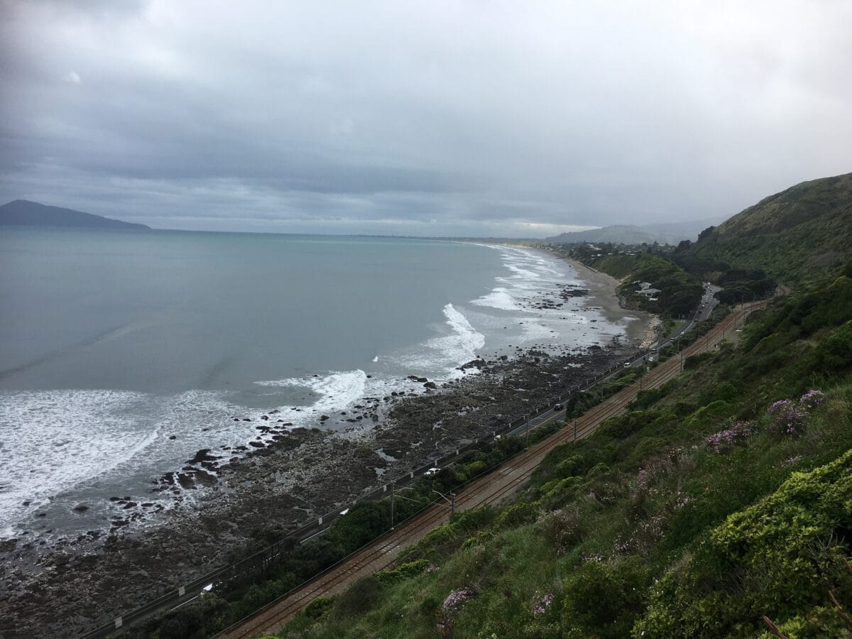
The Escarpment Track
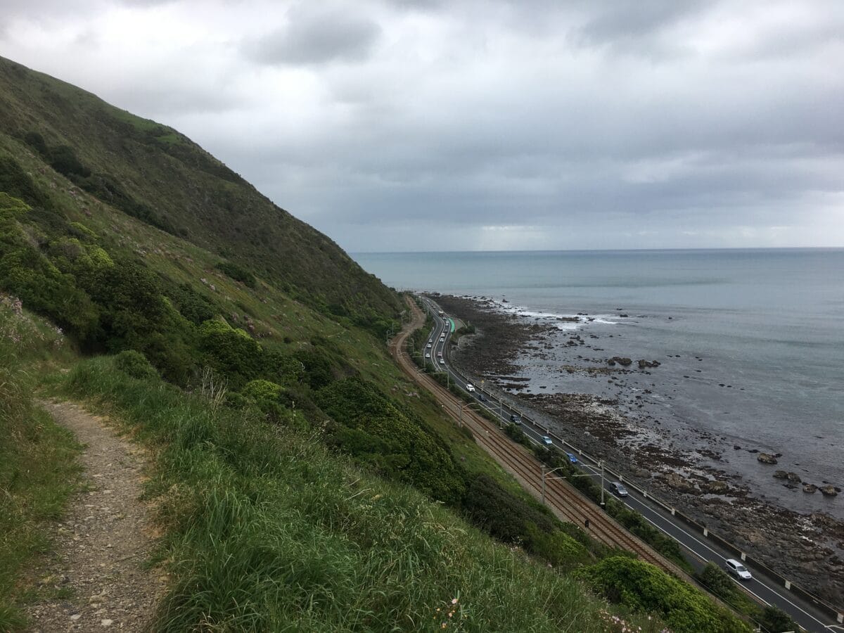
There are two ways to walk between Pukerua Bay and
Paekākāriki, the first is along the footpath which runs
Beside Centennial Highway, where there is a sea wall
To stop you falling in the water. However, there is no
Protection from on-coming traffic or the noise and
Pollution of breathing a mixture of sea air and carbon
Monoxide. There is a second way which is to take the
New, at times difficult, but extremely popular
Escarpment Track, which runs from Paekākāriki to
Pukerua Bay, taking in sweeping views of the spectacular
Kāpiti Coastline and the region’s famous Kāpiti Island.
Heading south, from Paekākāriki township, the trail
Starts by following the railway line then veers uphill
Across privately-owned farmland. You’ll climb 220
Metres above sea level and navigate steep, narrow
Pathways on what is one of the highlights of the
3000km ‘Te Araroa Walkway’ that stretches from Cape
Reinga in the north of New Zealand to Bluff in the south.
The Escarpment Track can be walked in either direction
But most choose to walk from north to south. While
Families of all ages regularly enjoy this trail, but it is not
An easy walk. There are around 1,200 steep steps
And walkers must navigate narrow pathways often
With only room for one person to squeeze past. High
Ridgelines and two quite precarious swing bridges add
A sense of adventure and danger to the mix, especially
When them bridges really start swinging. Getting to
The Escarpment Track from either Paekākāriki or
Pukerua Bay, is an easy three quarters of an
Hour journey from Wellington by train or car.
Follow the signposts to the start of the trail. The
Walking distance from station to station is 10km.
And remember, there are no handrails on the steps.
Children should be supervised and should you decide to
Accept this mission (impossible for someone like me)
Destroy these instructions and go and enjoy yourselves
To find out more about the Escarpment Track, read Vanessa Crowe’s article here.
paekakariki.nz gratefully received funding from:
Paekākāriki.nz is a community-built, funded and run website. All funds go to weekly running costs, with huge amounts of professional work donated behind the scenes. If you can help financially, at a time when many supporting local businesses are hurting, we have launched a donation gateway.
